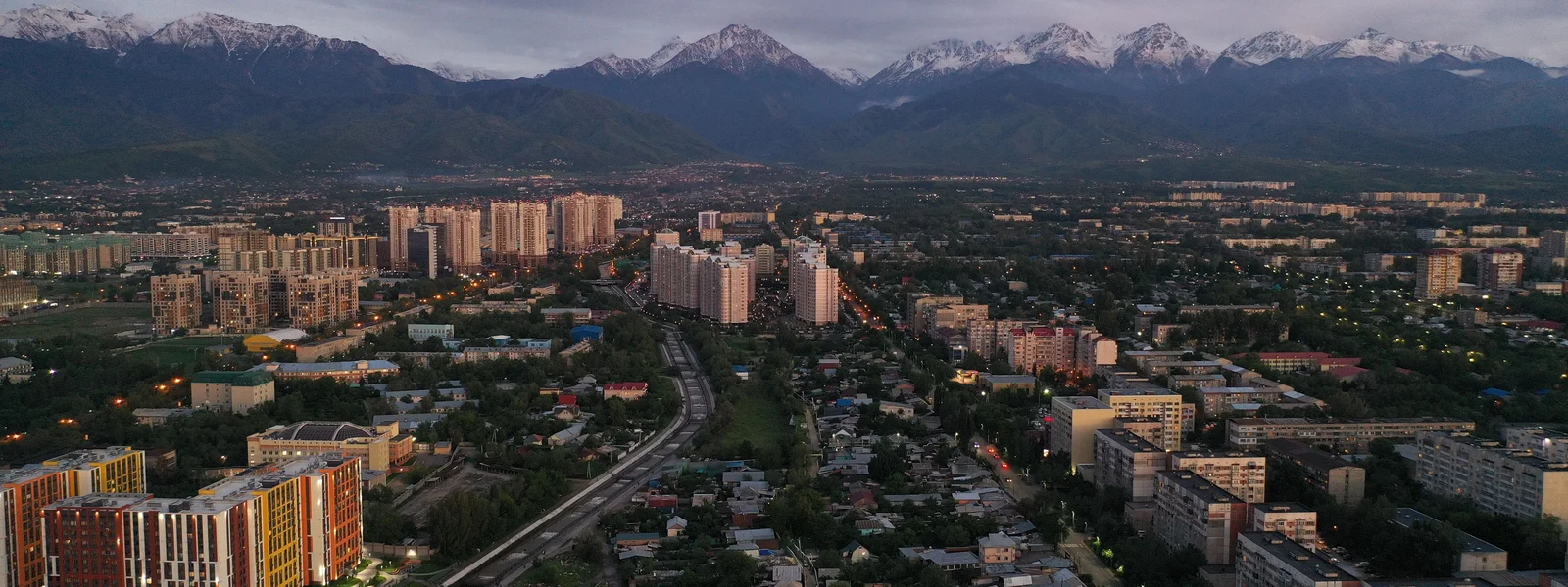
Almaty Mountains Esim
The Tian Shan mountains above Almaty represent one of Central Asia's most accessible high-altitude outdoor experiences: Shymbulak ski resort operates at 2,200 to 3,200 metres just 25 kilometres from the city centre, Big Almaty Lake sits at 2,511 metres at the end of a scenic gorge drive, and the Ile-Alatau National Park's hiking trail network reaches above 3,000 metres with views of the main Tian Shan ridge. These destinations are the primary draw for Almaty's growing international adventure tourism visitor base and present the connectivity character typical of alpine terrain: Beeline 4G in the settled lower sections transitioning to intermittent 3G in the mid-mountain zone and effectively offline above approximately 2,500 to 3,000 metres.
Shymbulak Ski Resort: Connectivity for Winter and Summer Visitors
Shymbulak operates year-round, with ski season from November through April and mountain biking and hiking from May through October. The resort is accessible by Yandex Taxi from Almaty city (30 to 45 minutes), by the gondola from Medeu skating rink (connecting to the higher ski lifts), or by private vehicle. Beeline 4G is present at the resort base area at 2,200 metres, providing adequate connectivity for the resort's WiFi-supplemented visitor services, social media sharing of mountain photography, and WhatsApp coordination with transport for the return to Almaty. Above the gondola midpoint and into the upper ski terrain above 2,800 metres, Beeline signal becomes intermittent 3G and is absent at the highest points. The resort's own WiFi network supplements Beeline coverage in the base area restaurant and lodge facilities.
| Location | Altitude | Beeline Signal | Note |
|---|---|---|---|
| Medeu skating rink base | 1691m | 4G strong | Full city connectivity |
| Shymbulak base area | 2200m | 4G good | Resort WiFi supplements |
| Gondola midstation | 2600m | 3G/4G variable | Brief connection windows |
| Upper ski area (Talgar Pass) | 3200m | Minimal | Essentially offline |
| Big Almaty Lake approach road | 2000-2400m | 3G/2G variable | Download offline before departing |
| Big Almaty Lake | 2511m | 2G limited | Lake itself mostly offline |
| Kok Zhailau meadow (hiking) | 2100-2600m | 3G variable | Beeline best option |
| Tian Shan ridge (3000m+) | 3000m+ | None | Offline; local guide recommended |
Big Almaty Lake: The Iconic Mountain Destination
Big Almaty Lake (Bolshoye Almatinskoe Ozero) is the most visited natural site in the Almaty region, a turquoise alpine lake at 2,511 metres altitude fed by glacial melt from the main Tian Shan ridge. The access road runs through the Ile-Alatau National Park gorge, passing the Institute of Astrophysics and reaching the lake at the gorge's head. Beeline 2G to 3G is present on the lower approach road and weakens progressively toward the lake, with the lake itself in a location that provides only occasional 2G signal. Download Google Maps offline for the access road and Maps.me for the lake area and the hiking routes above before departing from Almaty. The lake's extraordinary colour and the glacier backdrop make it one of Kazakhstan's most photographed sites, and the photographs accumulated during the visit are best uploaded from Almaty hotel WiFi in the evening rather than from the lake's minimal connectivity.
Hiking in the Ile-Alatau National Park
The Ile-Alatau National Park above Almaty has an extensive network of hiking trails ranging from accessible lower gorge walks to multi-day routes crossing the main Tian Shan ridge. The most popular day hike routes include the Kok Zhailau meadow trail (accessible from the Medeu area, reaching the alpine meadow at 2,100 to 2,500 metres), the Butakovsky Gorge waterfall walk, and the more demanding Kumbel trail reaching the main ridge. Beeline 3G is present on the lower sections of these trails and weakens above approximately 2,300 metres. Download trail maps from AllTrails or a dedicated hiking app before beginning any Ile-Alatau hike, as the trail network in the higher sections is not fully covered by Google Maps offline and requires dedicated trail data for confident navigation. Share trail plans with Almaty accommodation contacts before departing, as the offline sections above 2,500 metres mean communication with the city is impossible during the upper trail hours.
Safety Communication in the Almaty Mountains
The Ile-Alatau National Park above Almaty is visited by large numbers of local and international hikers during the summer season, and the park has a functioning ranger system with emergency contact protocols. Beeline connectivity in the lower trail sections means emergency communication is possible during the first hour or two of any ascent, but above the signal transition point (approximately 2,300 to 2,500 metres depending on the specific route), cellular communication is absent. Informing Almaty accommodation of the planned route and expected return time before departing for any upper mountain hike provides the safety net that cellular communication cannot. The mountains are not extreme in technical difficulty for the standard tourist routes, but weather can change rapidly and altitude effects can be underestimated by visitors arriving from sea level. Sensible hiking preparation, including downloaded trail maps, snacks, water, and warm layers, combined with the standard safety communication protocol, makes the Almaty mountain experience both accessible and safe.
Eagle Hunting and Rural Kazakhstan Connectivity
Eagle hunting demonstrations and authentic hunting experiences with Kazakh berkutchi (eagle hunters) are available through Almaty-based tour operators and represent one of Kazakhstan's most distinctive cultural tourism experiences. These experiences typically take place in the steppe and foothills areas south and east of Almaty, in locations where Beeline 2G to 3G provides basic connectivity for navigation and emergency communication but not reliable 4G for social media sharing in real time. The photography opportunity during eagle hunting sessions, with the trained golden eagle on the hunter's arm against the mountain backdrop, produces some of the most striking images available in Kazakhstan tourism. Defer the photo sharing to Almaty hotel WiFi in the evening, where the image quality and stable connectivity allow proper captioning and platform optimisation that the field connectivity cannot support. WhatsApp coordination with the berkutchi operator for pickup and logistics uses the available Beeline signal in the valley areas approaching the hunting grounds.
Ski Season Connectivity at Shymbulak
Shymbulak operates as one of Central Asia's most significant ski resorts, with a gondola connection from Medeu ice skating rink and ski terrain extending from 2,200 metres at the base to 3,200 metres at the summit of the accessible pistes. During ski season from November through April, the Shymbulak base area has Beeline 4G that handles ski pass booking via the resort app, Yandex Taxi to and from the gondola base at Medeu, and the ski run photography sharing that social media ski documentation demands. Above the base area gondola station, the signal follows the altitude-dependent pattern: present at the gondola midstation during good conditions, absent at the upper piste summit. Ski passes are purchased via the Shymbulak resort app or at the gondola base, with Beeline 4G enabling the app transaction. For ski rental, lift priority passes, and instructors, pre-booking via WhatsApp with the resort's international guest services team in advance from hotel WiFi is the most efficient approach.
Acclimatisation and the Data Requirement
Almaty sits at approximately 900 metres above sea level, and the mountain day trips to Shymbulak (2,200 metres), Big Almaty Lake (2,511 metres), and the hiking routes above (3,000 metres and higher) represent significant altitude gains for visitors arriving from sea-level cities. Altitude symptoms including mild headache, reduced energy, and slower pace of physical activity begin to affect some visitors above 2,500 metres and become more common above 3,000 metres. The practical connectivity implication is that altitude-affected visitors may be slower to return from mountain areas than planned, potentially extending into evening hours when Yandex Taxi from the mountain access roads is still necessary. Having the Yandex Taxi app pre-loaded with the hotel destination saved, bookable from any Beeline connectivity point on the return road, provides the transport logistics safety net for visits that run longer than planned due to altitude-related pace adjustment. Download the altitude sickness symptom guide from a health information source before departure from Almaty, saving it locally for offline access at elevation where the health information is most relevant.
The broader mountain safety consideration for Almaty's mountain visitors combines adequate offline map preparation with the reasonable expectation that the lower mountain sections maintain sufficient Beeline connectivity for emergency communication. The Ile-Alatau National Park ranger station contacts, saved locally in WhatsApp before departure, provide the local rescue coordination channel that should be the first contact in any mountain emergency above the cellular coverage zone. Kazakhstan's mountain rescue services operate through provincial rescue coordination, and the National Park ranger presence during peak hiking season provides trained initial response for common mountain incidents including ankle injuries and altitude-related illness.
The Mountain Experience Beyond Connectivity
The Ile-Alatau National Park above Almaty provides a mountain experience that competes with Switzerland, the Dolomites, and the Japanese Alps in scenery quality while remaining dramatically less visited and less developed commercially. The Beeline coverage in the lower sections and the offline character of the upper mountain zones is not a limitation but an appropriate reflection of the wilderness character that makes these mountains valuable. The offline hours above 2,500 metres, hiking through the alpine meadows and moraine terrain with the main Tian Shan ridge ahead, are the best hours of the mountain experience precisely because they require no connectivity and no screen. The eSIM that gets you from Almaty city to the Shymbulak gondola base and back is the practical enabler of the mountain experience, not the experience itself. Arrive equipped with Beeline connectivity and offline maps, reach the mountain, and allow the extraordinary alpine environment above Almaty to provide everything the mountain day requires without digital supplement.
Weather Monitoring for Mountain Days
Tian Shan weather above Almaty changes more rapidly than the city weather below suggests, with afternoon thunderstorms developing from clear morning skies in summer and snow arriving at altitude from overnight systems that were invisible the evening before. Checking the Shymbulak or Big Almaty Lake specific mountain forecast before any upper mountain day, using a weather app with mountain-specific forecast capability such as Mountain Forecast or the Shymbulak resort's own weather service, provides better altitude-specific information than general Almaty city forecasts. This weather check from hotel WiFi the evening before, combined with a morning check on Beeline 4G before departing the city, provides the forecast baseline for go or no-go decisions on upper mountain hiking and skiing. The offline functionality requirement for mountain areas means this forecast check must happen while connected in the city rather than at the trailhead where signal may be absent. Download the forecast screenshot or save it locally if the mountain morning weather check needs to be consulted offline during the hike planning at the trailhead.
The Almaty mountain experience above the city is among the most accessible high-altitude natural environments available from any Central Asian urban base, and the Beeline connectivity that serves its lower sections combined with the offline preparation that covers its higher zones provides the complete navigation and communication framework for mountain days that are as rewarding as any in the region. The Ile-Alatau National Park above Almaty is one of Central Asia's great outdoor destinations, and the Beeline connectivity that extends into its lower valleys combined with the offline map preparation for its upper trails provides the navigation confidence and safety communication framework that makes independent mountain exploration above one of the region's finest cities genuinely accessible.Kazakhstan's connectivity infrastructure in 2026 provides the digital foundation for one of the most rewarding and undervisited travel destinations in the world, and visitors who arrive with a Beeline eSIM installed, offline maps downloaded, and Yandex Taxi registered will find that every aspect of the Kazakhstan circuit, from the Almaty mountain gondola to the Astana architectural boulevards to the red rock formations of Charyn Canyon, is practically supported by the connectivity tools that.Get Your Kazakhstan eSIM
Compare Beeline-based Kazakhstan plans for Almaty, Astana, and mountain travel.
FAQ
How much data and what kind of plan do travelers need in Kazakhstan?
Almaty sits at approximately 900 metres above sea level, and the mountain day trips to Shymbulak (2,200 metres), Big Almaty Lake (2,511 metres), and the hiking routes above (3,000 metres and higher) represent significant altitude gains for visitors arriving from sea-level cities. Altitude symptoms including mild headache, reduced energy, and slower pace of physical activity begin to affect some visitors above 2,500 metres and become more common above 3,000 metres. The practical connectivity implication is that altitude-affected visitors may be slower to return from mountain areas than planned, potentially extending into evening hours when Yandex Taxi from the mountain access roads is still necessary.
What should travelers prepare before entering low-coverage areas in Kazakhstan?
Big Almaty Lake (Bolshoye Almatinskoe Ozero) is the most visited natural site in the Almaty region, a turquoise alpine lake at 2,511 metres altitude fed by glacial melt from the main Tian Shan ridge. The access road runs through the Ile-Alatau National Park gorge, passing the Institute of Astrophysics and reaching the lake at the gorge's head. Beeline 2G to 3G is present on the lower approach road and weakens progressively toward the lake, with the lake itself in a location that provides only occasional 2G signal. Download Google Maps offline for the access road and Maps.me for the lake area and the hiking routes above before departing from Almaty.
What is the connectivity picture in Kazakhstan?
The Ile-Alatau National Park above Almaty provides a mountain experience that competes with Switzerland, the Dolomites, and the Japanese Alps in scenery quality while remaining dramatically less visited and less developed commercially. The Beeline coverage in the lower sections and the offline character of the upper mountain zones is not a limitation but an appropriate reflection of the wilderness character that makes these mountains valuable. The offline hours above 2,500 metres, hiking through the alpine meadows and moraine terrain with the main Tian Shan ridge ahead, are the best hours of the mountain experience precisely because they require no connectivity and no screen.
What should travelers know about hiking in the ile-alatau national park in Kazakhstan?
The Ile-Alatau National Park above Almaty has an extensive network of hiking trails ranging from accessible lower gorge walks to multi-day routes crossing the main Tian Shan ridge. The most popular day hike routes include the Kok Zhailau meadow trail (accessible from the Medeu area, reaching the alpine meadow at 2,100 to 2,500 metres), the Butakovsky Gorge waterfall walk, and the more demanding Kumbel trail reaching the main ridge. Beeline 3G is present on the lower sections of these trails and weakens above approximately 2,300 metres.