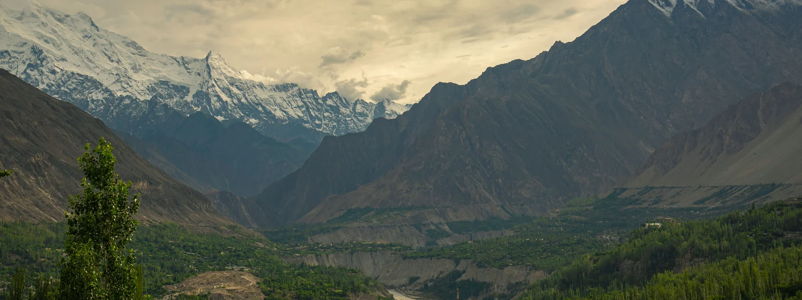
Karakoram Highway Connectivity Guide 2026: Signal Section by Section
The Karakoram Highway is one of the world's great road journeys: 1,300 kilometres of asphalt, gravel, and mountain engineering connecting Islamabad to the Chinese border at Khunjerab Pass, reaching 4,693 metres at the pass itself and passing through some of the most dramatic mountain terrain accessible by road anywhere on Earth. The KKH's connectivity profile is a direct reflection of its geography: signal is present in the inhabited valley floors and town centres that punctuate the route, and absent in the deep gorges, tunnels, and uninhabited mountain sections that represent the road's most dramatic visual character. Understanding this section-by-section reality allows appropriate offline preparation and realistic expectations for one of Pakistan's signature travel experiences.
Islamabad to Abbottabad: Well-Connected Entry Section
The KKH journey from Islamabad or Rawalpindi to Abbottabad covers the first 120 kilometres of the route through the Hazara Division foothills. Jazz 4G is reliable throughout this section, which passes through populated agricultural areas and market towns with good tower infrastructure. Abbottabad itself has solid Jazz and Zong 4G. This is the last section of the journey with consistent urban-quality connectivity before the terrain becomes more demanding. Conduct any final WhatsApp coordination with Hunza guesthouses, check mountain weather forecasts, and top up any online bookings from Abbottabad's connectivity before heading into the more variable Mansehra to Besham section.
| KKH Section | Jazz Signal | Key Towns | Practical Action |
|---|---|---|---|
| Islamabad to Abbottabad | 4G strong throughout | Abbottabad | Normal city connectivity |
| Abbottabad to Besham | 3G/4G in towns; offline gorges | Mansehra, Besham | Download Besham offline map |
| Besham to Chilas | 2G/3G variable; offline tunnels | Chilas | Longest offline section; Indus gorge |
| Chilas to Gilgit | 3G/4G improving | Gilgit | Signal returns approaching Gilgit |
| Gilgit to Karimabad | 3G/4G valley floor | Best northern connectivity zone | |
| Karimabad to Passu | 2G/3G variable | Gulmit, Passu | Weakening signal; offline above villages |
| Passu to Sost | 2G limited | Sost | Border town; minimal connectivity |
| Sost to Khunjerab Pass (4693m) | No signal | Khunjerab | Fully offline; satellite device for safety |
Besham to Chilas: The Indus Gorge Offline Section
The section between Besham and Chilas, approximately 230 kilometres through the Indus Gorge, is the longest consistently offline section of the KKH journey. The road descends to river level in places and passes through the gorge terrain where the Indus has carved one of the deepest canyon systems in Asia. The physical depth of the gorge, the overhanging cliff sections, and the tunnels through protruding rock spurs create a signal-blocking environment that no operator has overcome with commercial tower investment. Jazz signal is present at Besham and Chilas at each end of this section, with occasional brief appearances in areas where the gorge widens at tributary junctions. Between these brief connections, the gorge section is genuinely offline for stretches of one to three hours of driving. The offline preparation protocol from Islamabad, downloading the complete KKH route in Maps.me, provides navigation for this entire section without any live data dependency.
Gilgit: The Northern Hub
Gilgit city, the administrative capital of Gilgit-Baltistan province, has Jazz and Zong 4G throughout its urban area and represents the best connectivity available in the entire northern mountain region. Download any pending offline content from Gilgit hotel WiFi or Jazz 4G before heading further north or west toward Skardu. WhatsApp coordination with Hunza guesthouses, final weather forecasts, and any research on the Hunza Valley routes is most efficiently done from Gilgit's connectivity rather than from the more variable signals in the smaller valley towns. Gilgit airport, connecting the city to Islamabad by a 40-minute PIA flight, has Jazz connectivity throughout the terminal.
Hunza Valley: The Connectivity Hub of the North
Karimabad, the main tourist town of Hunza Valley, has Jazz 3G to 4G in the village centre around the central bazaar and the approaches to Baltit Fort. This connectivity, while slower and less consistent than Gilgit or Islamabad, is sufficient for WhatsApp communication, navigation within the valley, and moderate social media activity. The signal weakens above Karimabad as the jeep tracks climb toward the old Silk Road sections and the higher pastures. Aliabad, five kilometres below Karimabad in the valley, has similar Jazz coverage. Gulmit and Passu, further north toward the Chinese border, have progressively weaker coverage that drops to 2G or absent above the village centres.
Khunjerab Pass: The Highest Point
Khunjerab Pass at 4,693 metres is the highest paved international border crossing in the world and the northern terminus of the Pakistan side of the KKH. All operators are offline at this elevation; the combination of altitude, distance from inhabited centres, and the international border zone sensitivity mean no commercial tower infrastructure serves this point. The drive from Sost to the pass, approximately 85 kilometres, is offline throughout. The visual experience of the pass itself, with its yaks grazing at altitude and the dramatic mountain panorama straddling Pakistan and China, is one that requires no connectivity to appreciate and produces photography that will be uploaded from lower elevation hotel WiFi on the return journey. For visitors planning to cross into China, the Chinese side of the pass has China Mobile infrastructure that provides Chinese network connectivity once across the border.
Power Banks and Battery Management
The extended offline sections of the KKH, combined with the cold temperatures at elevation that reduce smartphone battery efficiency, make power bank capacity a practical consideration for the journey. At temperatures below 10 degrees Celsius, lithium batteries deliver reduced capacity compared to their rated specification, and the cold nights at Karimabad and above can affect overnight charging effectiveness. A 20,000mAh power bank provides reliable multi-day capacity for the KKH sections where vehicle charging may be the only available power source during long driving days. Download all entertainment for the offline sections before departing Islamabad, as the combination of dramatic scenery and absent connectivity creates ideal conditions for audio content consumption during the gorge driving hours.
Chilas: The Midpoint Town
Chilas, situated at the junction of the KKH and the road to Fairy Meadows and Nanga Parbat base camp, is the key midpoint town between Islamabad and Gilgit and the end of the long Besham to Chilas offline section. Jazz 4G in Chilas is the return to reliable connectivity after the Indus Gorge crossing, and the town serves as the recharge and reconnection point for both vehicle and phone batteries on the standard Islamabad to Gilgit drive. WhatsApp check-ins from Chilas confirm to family and support network that the gorge section has been completed safely, and the brief connectivity window enables navigation confirmation for the remaining Chilas to Gilgit section. The Nanga Parbat massif is visible from Chilas on clear days; the turnoff for Fairy Meadows and the Beyal base camp approach to the world's ninth highest mountain is 50 kilometres north of Chilas on a jeep track with no mobile coverage whatsoever.
Gilgit to Skardu: The Eastern Alternative
Skardu, the administrative capital of Baltistan and the base for K2, Broad Peak, and Gasherbrum expeditions, is accessible from Gilgit by a five to six hour road journey east along the Indus River through the Indus Gorge. Jazz coverage on this route follows the same pattern as the main KKH: present in Gilgit city and in the Skardu town area, with limited to absent coverage in the gorge sections between. Skardu town has Jazz 4G adequate for basic travel tasks. The approach routes to K2, Concordia, and the high-altitude climbing objectives of Baltistan are entirely offline above Skardu, with the typical expedition start point of Askole at 3,040 metres having minimal or no signal. Serious mountaineering expeditions operating in this area carry satellite communication as standard equipment; the cellular network contributes nothing to safety communication above the main Skardu basin.
Naran and the Babusar Pass Alternative Route
An increasingly popular alternative to the standard KKH route for visitors travelling from Islamabad to Gilgit is the Babusar Pass route via Naran, which traverses the Kaghan Valley before crossing the 4,173-metre Babusar Pass into Chilas. This route, only accessible from June through September when the pass is clear of snow, offers dramatic Kaghan Valley scenery and the Lulusar Lake high-altitude beauty as an alternative to the Besham to Chilas gorge section of the standard KKH. Jazz coverage in Naran, the main town of the Kaghan Valley, is 3G to 4G adequate for guesthouse coordination and weather monitoring. Above Naran toward the Babusar Pass, coverage decreases with altitude and is absent at the pass itself. The offline navigation considerations for the Babusar Pass route are identical to the Besham to Chilas section: download offline maps for the complete route before leaving Islamabad or Abbottabad, where Jazz 4G provides reliable download speeds for large offline packs.
The Babusar Pass route reunion with the KKH at Chilas completes a loop that avoids the Besham to Chilas gorge repeat for visitors returning from the north via a different route, creating a genuine circuit that showcases two of Pakistan's most distinct mountain environments within a northern Pakistan itinerary.
The KKH in Context: Worth Every Offline Kilometre
The Karakoram Highway is one of the world's engineering achievements and one of its great travel experiences regardless of its connectivity status. The offline sections, particularly the Indus Gorge between Besham and Chilas, are offline because no commercial tower investment justifies serving uninhabited gorge terrain at altitude, not because Pakistan's network has failed. The inhabited sections of the highway, where Jazz provides the coverage that local residents and traders depend on, are connected at the same level as any rural Pakistani town. Understanding the KKH's connectivity as a reflection of its geography rather than a deficiency of its telecommunications makes the offline preparation approach sensible rather than precautionary: you prepare for offline sections not because they might be offline, but because they definitely are, and the landscape that creates this offline geography is precisely what makes the journey extraordinary. Download the maps, charge the power bank, accept the gorge sections as the most dramatic and least connected hours of the journey, and the KKH delivers one of Asia's great road travel experiences.
The Karakoram Highway's continued improvement, with ongoing infrastructure investment from both the Pakistan government and Chinese CPEC funding creating better road surfaces and tunnel completions, is making the journey more accessible each year and the connectivity investments that follow commercial development in the inhabited sections are expanding the connected portions of the route incrementally.The KKH connectivity guide ultimately describes a journey where the connectivity picture exactly mirrors the experiential one: rich with information and connection in the inhabited sections, silent and self-reliant in the spectacular gorge and mountain sections. The offline preparation described throughout this guide provides the navigation tools for the silent sections, and the Jazz coverage in the inhabited sections provides the communication capability that maintains the circuit's logistics without requiring constant connectivity. The KKH rewards travellers who approach it as the extraordinary mountain road it is, prepared for both its connected and offline character, and the eSIM user who completes the Islamabad offline preparation protocol before departure is ready for everything the highway delivers.
The Karakoram Highway connectivity guide represents one of the most specific and geography-driven travel connectivity analyses in Asia, because the KKH's terrain directly determines its coverage in a way that urban environments, where commercial investment follows population density, cannot match. The mountains create the offline sections; the inhabited sections create the connected ones; the offline preparation protocol bridges them. The KKH's combination of world-class mountain scenery, genuine engineering achievement, and culturally rich inhabited sections makes it one of the most rewarding road journeys in Asia regardless of its connectivity status, and the Jazz coverage in the inhabited sections provides the communication and navigation capability that makes the journey self-directed and logistically manageable without sacrificing the offline grandeur of the gorge sections that remain the most memorable hours of the drive.Get Your KKH eSIM
Compare Jazz-based Pakistan plans for the Karakoram Highway and northern mountain circuit.
FAQ
Is there mobile signal on the Karakoram Highway?
Jazz provides coverage in inhabited valley sections and town centres. The deep Indus Gorge between Besham and Chilas is the longest offline section, with no signal for several hours of driving. Download full KKH offline maps before departing Islamabad.
What signal is there in Karimabad Hunza?
Jazz 3G to 4G in the main village centre and bazaar area. Signal weakens above the village and is absent on trails above approximately 3,000 to 3,500 metres.
Is Khunjerab Pass covered by any network?
No. The pass at 4,693 metres is offline on all Pakistani operators. The drive from Sost to the pass is also offline throughout. Chinese networks are available on the Chinese side of the border.
Do I need a satellite communicator for the KKH?
For the standard KKH drive on the paved highway, local guide support and Jazz in town centres provide adequate safety communication. For serious high-altitude trekking, Fairy Meadows, K2 base camp approaches, and glacial routes, a satellite communicator is strongly recommended.